

Maps show Canada wildfire smoke forecast for U.S.
Maps show Canada wildfire smoke forecast for U.S.
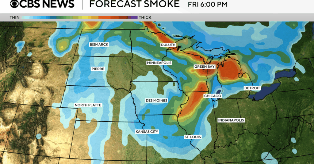
Wildfire smoke from Canada is expected to move over the U.S., and maps and satellite imagery show the large-scale impact of the blazes.
Read the full article on CBS World
Truth Analysis
Analysis Summary:
The article's main claim about wildfire smoke from Canada impacting the U.S. is accurate and supported by multiple sources providing maps and data. The article appears to be primarily informative, with minimal discernible bias. Some details, such as the specific scale of impact, are not fully elaborated upon, but the core message is verifiable.
Detailed Analysis:
- Claim:** Wildfire smoke from Canada is expected to move over the U.S.
- Verification Source #1: Supports this claim by providing a Canada smoke forecast map.
- Verification Source #2: Supports this claim by providing an AirNow Fire and Smoke Map showing particle pollution from wildfires.
- Verification Source #3: Supports this claim by providing a US/Canada fire map and data.
- Verification Source #4: Supports this claim by providing access to maps and data related to fire and smoke.
- Verification Source #5: Supports this claim by providing an interactive map with data for air quality monitors in the U.S., Canada, and Mexico.
- Claim:** Maps and satellite imagery show the large-scale impact of the blazes.
- Verification Source #1: Provides maps showing the forecast of smoke, indicating the scale of impact.
- Verification Source #2: Provides a map showing fine particle pollution, indicating the scale of impact.
- Verification Source #3: Provides a fire map and data, implying satellite imagery is used to generate the data.
- Verification Source #4: Provides maps and data related to fire and smoke.
- Verification Source #5: Provides an interactive map with data for air quality monitors.
Supporting Evidence/Contradictions:
- Verification Source #1, #2, #3, #4, and #5: All provide maps and data that support the claim that wildfire smoke from Canada is impacting the U.S. and that the impact can be visualized through maps and satellite imagery. There are no contradictions between the sources. The sources agree on the presence of wildfire smoke and its movement.