

Maps show where devastating flash flooding hit Texas
Maps show where devastating flash flooding hit Texas
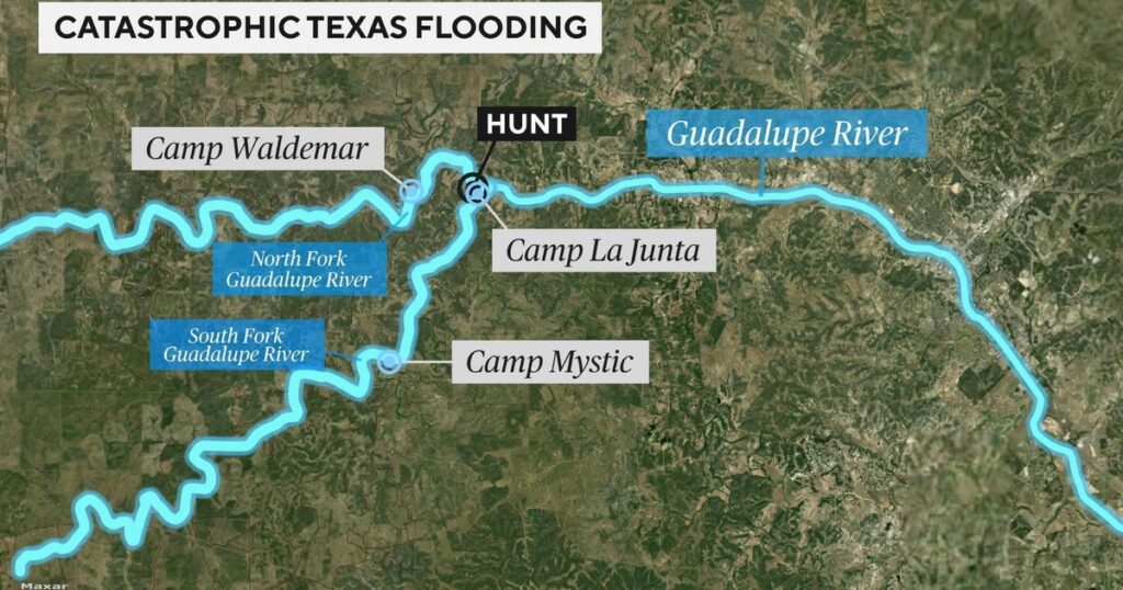
Multiple parts of central Texas, including Kerr County, were shocked by flash floods Friday when the Guadalupe River rose rapidly.
Read the full article on CBS US
Truth Analysis
Analysis Summary:
The article is mostly accurate, focusing on the flash floods in central Texas, particularly Kerr County. The claim about the Guadalupe River rising rapidly is supported by multiple sources. There is minimal observable bias.
Detailed Analysis:
- Claim:** "Multiple parts of central Texas, including Kerr County, were shocked by flash floods Friday when the Guadalupe River rose rapidly."
- Verification Source #2: Supports the claim that catastrophic flooding struck central Texas and caused the Guadalupe River near Kerrville to surge.
- Verification Source #3: Supports the claim that the catastrophic floods hit central Texas.
- Verification Source #4: Supports the claim that the flash flooding struck on Friday.
- Verification Source #5: Supports the claim that the area of Central Texas was devastated by historic flash floods.
Supporting Evidence/Contradictions:
- Verification Source #2: "FLASH FLOODING: Catastrophic flooding struck central Texas yesterday, causing the Guadalupe River near Kerrville to surge by more than 20-26…" This supports the claim about the Guadalupe River rising rapidly in Kerr County.
- Verification Source #3: "The catastrophic floods hit central Texas on July 4." This supports the claim about the floods hitting central Texas.
- Verification Source #4: "The unexpected flash flooding struck on Friday…" This supports the claim about the floods occurring on Friday.
- Verification Source #5: "Map shows the area of Central Texas devastated by historic flash floods." This supports the claim about the floods devastating central Texas.
- All sources generally agree on the location and timing of the floods.